Arizona State Society, DAR, Historical and Commemorative Markers
Sentinel Peak a.k.a. "A" Mountain: Lookout and Site of Signal Fires
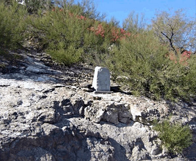
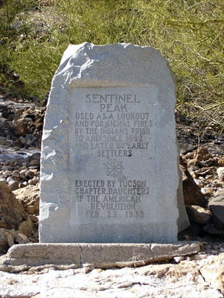
Marker: Sentinel Peak, also known as “A” Mountain: Lookout and Site for Signal Fires
Location: Tucson Mountains, southwest of downtown Congress Street, on Sentinel Peak Road.
From I10, take the Congress Street Exit west and proceed to South Cuesta Avenue. Turn left at Cuesta Avenue, which becomes Sentinel Peak Rd S. The one-way road loops directly in front of the marker. There is also free parking and many trails to hike.
Historical Significance: Used as a lookout and as a site for signal fires by Native Americans and other settlers. The marker reads, “Sentinel Peak / Used as a lookout and for signal fires by the Indians prior to and since 1692 and later by early settlers. Erected by Tucson Chapter, Daughters of the American Revolution Feb. 22, 1933.”
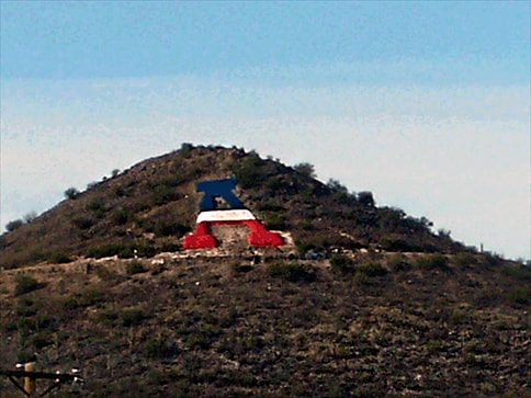
Geological Significance: Sentinel Peak, more commonly known as “A” Mountain,is a prominent ridge in the Tucson Mountains west of Tucson, Arizona. Sentinel Peak rises 2,897 feet to the west of the Santa Cruz River. The underground ridge of rock, running to the east, once forced groundwater to the surface. The resulting floodplain was used for agricultural fields from about 4,000 years ago until the 1930s. Residents of the nearby village of Schook-schon (Tucson) were visited by Father Francisco Kino, who established nearby Mission San Xavier del Bac, in the 1690s. When the nearby Presidio of Tucson was constructed in 1775, a sentinel stood on the top of the peak searching the horizon for raiding Apache warriors.
Sentinel Peak is made up of a series of volcanic rocks that represent different types of volcanic activity, though the mountain itself is not a volcano. Erosion and faulting are responsible for the mountain’s place in Tucson and its conical shape. It rests on a foundation of bedrock and is dominated by 20‑ to 30‑million-year old volcanic rocks. Volcanic ash and breccia, along with ancient lava beds, can be also be found on the mountain, as further evidence of a once active volcanic field that formed the Tucson Mountain ranges. (Source: Wikipedia)
The content contained herein does not necessarily represent the position of NSDAR.Hyperlinks to other sites are not the responsibility of the NSDAR, the state organization or individual DAR chapters.
Unless otherwise noted, images are courtesy of Arizona State Society, DAR, Daughters.