Arizona State Society, DAR, Historical and Commemorative Markers
Walking Tour of the Tucson Presidio: Presidio San Agustín del Tucson Visiting Seven Historical Markers
Orientation: This walking tour of the Tucson Presidio takes you to the sites of six historical markers installed in the 1920’s and 1930s with an optional visit to the seventh site. Each marker is further described in a separate page.
Parking: Parking is available at the underground parking garage, 165 W. Alameda Street. Street parking is also available.
Begin the tour: Start at the marker in the Plaza de las Armas, which is marked #1 on the map.
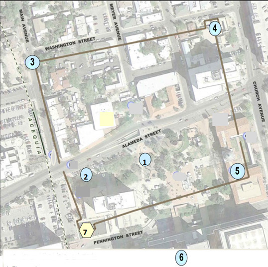
Overview of the walking tour, February 2024.
#1 Plaza de las Armas: Raising of the Flag
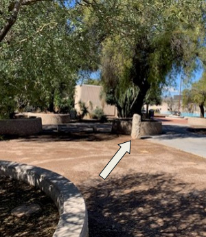
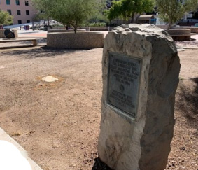
The elevators from the underground parking garage make it easy to locate the first marker, as it is visible to someone exiting elevators #2 or #3. It is a tall granite stone with a plaque that faces Alameda Street.
View of the marker with Alameda Street on the right.
View of the marker with Alameda Street to the left.
#2 Gateway: North Entrance
Head west along Alameda Street (to your left). Sunset Park, behind Tucson City Hall, is home to several monuments, including the next marker on the tour. Along the sidewalk, before you get to Main Avenue, you can see the marker on your left.
This marker commemorates the north entrance to the Presidio, also known as the Walled City of Tucson. View north gateway marker details.
#3 Adobe Wall: Northwest Corner
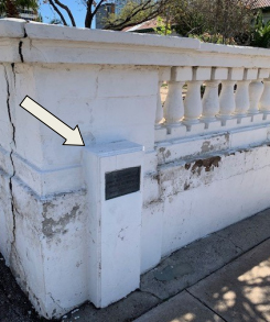
At Main Avenue, turn right and cross the street. Walk on the right side of Main Avenue in front of the Tucson Museum of Art housed in some of the original houses of the area. The next marker is knee-height in the street-side wall of the J. Knox Corbett House, at the southeast corner of Main Avenue and Washington Street. Be sure to look down!
This marks the northwest corner of the adobe wall that surrounded the Presidio.
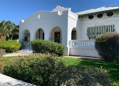
View of the J. Knox Corbett House, part of the Tucson Museum of Art, February 2024.
Marker shown embedded in the street-side wall of the Corbett House, February 2024.
#4 Adobe Wall: Northeast Corner
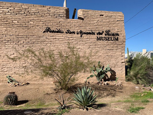
Turn right (east) on Washington Street. As you walk along, you are following the path of the northern portion of the adobe wall that surrounded the Presidio San Agustín del Tucson. Pass Meyer Street, shops, and a restaurant. The entrance to a re-creation of the Presidio is found at 196 Court Avenue. Named the Presidio San Agustín del Tucson Museum, this venue was constructed in the early 2000s to depict life in the Presidio era, 1776-1850.
Inside the museum is a marker of the northeast corner of the adobe wall that surrounded the Presidio.
Exterior of the Presidio San Agustin del Tucson Museum, February 2024.
#5 Adobe Wall: Southeast Corner
A segment of the reconstructed adobe wall along Washington Street, February 2024.
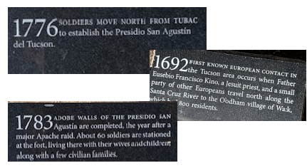
After visiting the Presidio museum, return to Washington Street and continue walking east (right) past the tall reconstructed walls of the Presidio. Notice the dateline with events of the area along Washington Street that continues on Church Street.
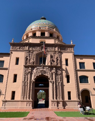
Turn right (south) on Church Street. Cross Alameda Street to the former Pima County Courthouse, the beautiful domed building now known as the Pima County Historic Courthouse.
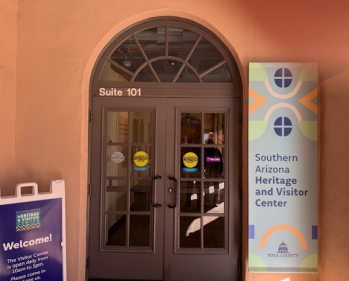
The building wing to the left now houses the University of Arizona Alfie Norville Gem & Mineral Museum. The southeast corner of the adobe wall was in that area, but the marker has been moved to the Southern Arizona Heritage and Visitor Center in Suite 101. Admission is free. The visitor center has information about other self-guided tours, including the green-line tour referenced below.
Details of the timeline along Washington and Church Streets, February 2024.
The former Pima County Courthouse, now called the Pima County Historic Courthouse, February 2024.
The entrance to the site of the southeast corner of the Presidio, February 2024.
#6 Gateway: South Entrance
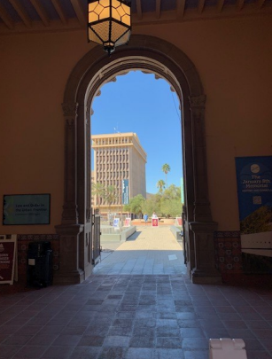
After leaving the visitor center, go through the Pima County Historic Courthouse via an arched passageway. Keep walking, and you will arrive at a memorial garden. Continue, and you will see the parking garage elevators where the walking tour begins.
On your left are several Pima County Courthouse buildings. Continue that direction (south) to visit the south gateway marker and the site of the southwest corner of the adobe wall.
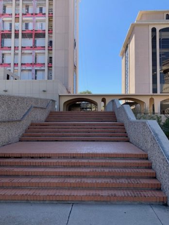
In order to safely and easily reach the sixth marker, follow the steps or ramp to the bridge across Congress Street.
After you cross the bridge, turn left into La Placita Park. The marker can be found on the other side of the gazebo inside the fenced area. Some maps call this area Plaza de la Mesilla.
Arched doorway exiting the passthrough to the memorial garden and Plaza de las Armas, February 2024.
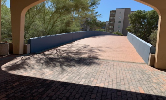
Steps to the bridge over Congress Street, February 2024.
Congress Street bridge, February 2024.
The gazebo in La Placita Park, 1967. The position of the marker is shown with arrows. Photographer is Art Grasberger, Tucson Citizen, the Arizona Daily Star. Request for permission to use is pending.
You may retrace your steps to the Plaza de las Armas and the elevators to the parking garage and conclude the tour here. Or continue to the site of the fourth corner of the adobe wall, the southwest corner, as described below.
#7 Adobe Wall: Southwest Corner
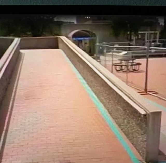
Follow the green line in the sidewalk to the site of the southwest corner of the adobe wall. Although the original DAR corner marker was destroyed, there are other historical markers at this site.
The content contained herein does not necessarily represent the position of NSDAR.Hyperlinks to other sites are not the responsibility of the NSDAR, the state organization or individual DAR chapters.
Unless otherwise noted, images are courtesy of Arizona State Society, DAR, Daughters.