Arizona: Historical Maps

1860 Arizona Territory
Thumbnail link to 1860 R. P. Kelley's Map of the Territory of Arizona.
Title: R. P. Kelley's Map of the Territory of Arizona
Published: St. Louis, Missouri: Theodore Schrader, 1860.
Library of Congress

R. P. Kelley’s Map of the Territory of Arizona, 1860, shows the territory of Arizona when it ran east to west and included what became the southern portion of Arizona and southwest portion of New Mexico. The map details Castle Dome, Ewell, and Mesilla counties, Tucson, and Fort Yuma, California.

The legend at the top right of the map explains the markings for:

Overland mail routes
Mail stations
Mines
Forts
Roads
Towns
County towns
Territory and county lines

1867 Arizona and New Mexico
Thumbnail link to 1867 map of Arizona and New Mexico.
Title: Arizona and New Mexico
Published: 1867
Library of Congress

This 1867 map of the territories of Arizona and New Mexico, with portions of northern Mexico, shows how the terrain and location of water shaped transportation routes hundreds of years before these routes were adapted for 19th century travel.

Communities in northern Arizona include Hardyville, Mohave City, Wickenburg, and Prescott, the first capital of the territory. Tucson and numerous smaller communities are noted in southern Arizona and northern Mexico.

1876 Arizona Stage Lines and More
Thumbnail link to 1876 transportation map of Arizona Territory.
Title: Indexed Map of Arizona showing the Stage Lines, Counties, Lakes & Rivers
Published: Chicago, Illinois: Rand McNally and Company, 1876
Library of Congress

This indexed map of Arizona, dated 1876, presents a wealth of information about the growing transportation infrastructure.

Phoenix is noted along with Hayden’s Ferry and Dragoon Spring.

At this time, we do not have access to the index.

1876 Territory of Arizona
Thumbnail link to 1876 map of Arizona territory.
Title: Territory of Arizona
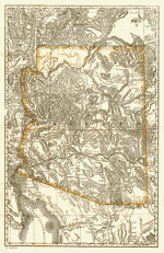
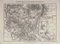
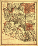
Published: Washington, D.C.: United States General Land Office, 1876
Library of Congress

This Department of the Interior General Land Office map of 1876 presents information about land use:

Subdivided townships
County seats
Cities and towns
Boundaries of land districts
Limits of railroad land grants
Military reservations
County boundaries
Indian tribal lands

1879 Territories of Arizona and New Mexico
Thumbnail link to 1879 map of Arizona and New Mexico territories.
Title: Territories of New Mexico & Arizona
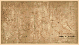
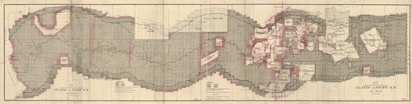
Published: Washington, D.C.: United States Army, Office of the Chief of Engineers, 1879
Library of Congress

This 1879 map, from the U. S. Army Office of the Chief of Engineers, 1860, documents the challenges of building railroads and roads through the Southwest. Mountain and passes are shown in great detail.

1883 A&P Railroad Land Grant
Thumbnail link to 1883 map showing the land grants along the A & P Railroad right of way.
Title: Map Showing the Location of the Road and the Land Grant of the Atlantic and Pacific R.R. in Arizona . . . in New Mexico
Not published. Dated 1883.
Library of Congress

This two-state map, 1883, describes the fifty-mile limit along the Atlantic & Pacific (A&P) Railroad right of way. The sections (one square mile or 640 acres) were granted to the A&P railroad by the federal government in a checkered pattern. The railroad could sell the land, providing funds for construction.

Such land grants greatly influenced the development of Arizona.

1885 Phoenix, Arizona
Thumbnail link to 1885 perspective map of Phoenix.
Title: Bird’s Eye View of Phoenix, Maricopa Co., Arizona
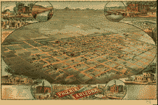
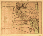
Published: Phoenix: Schmidt, Label & Litho. Co., ca 1885
Library of Congress

This 1885 lithograph, a bird’s eye view of Phoenix, includes the courthouse, hotel, billiard hall, church buildings, a school, bank, and other civic buildings. Irrigation infrastructure includes:

Dutch Ditch
Maricopa Canal
Grand Canal
Arizona Canal

The map contains a description of Phoenix, including a statement that the population was about 3,500.

1887 Arizona Railroads and Counties
Thumbnail link to 1887 map of Arizona’s railroad and counties.
Title: Railroad and County Map of Arizona
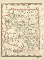
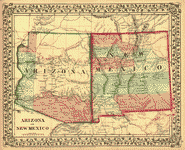
Published: New York: George Franklin Cram, 1887
Library of Congress

This 1887 map of railroads and county lines is similar to but less detailed than the 1879 map by the U.S. Army Office of the Chief of Engineers.

At this time, we do not have access to the index.

1887 Territory of Arizona
Thumbnail link to 1887 map of Arizona territory
Title: Territory of Arizona
Published: United States, General Land Office, 1887
Library of Congress

The 1887 map of the Arizona territory, from the United States General Land Office, includes high-lighting of land reserved for military and Indian tribes and forty- and fifty-mile limits of railroad land grants.


Contact the Webmaster

Request Membership Information


The content contained herein does not necessarily represent the position of NSDAR.
 Hyperlinks to other sites are not the responsibility of the NSDAR, the state organization or individual DAR chapters.


Unless otherwise noted, images are courtesy of Arizona State Society, DAR, Daughters.


Skip to content